
Walk a St. Charles Street
A sound search builds evidence in layers. The assessment roll identifies the parcel and owner of record, but it does not name each person who stays there. GIS establishes map context. Deeds supply title parties, while voter and directory records add limited, dated links between a name and an address.
- Decide whether the address belongs in Kane or DuPage County. Look for “ST CHARLES CITY” or “CITY OF ST CHARLES” among the taxing bodies.
- For Kane, search Kane DevNet. Save the PIN, situs address, legal description, tax year, and owner.
- Open KaneGIS4 and inspect the parcel, nearby lots, and districts.
- Carry the PIN to the Kane Land Records Search. Record each party's role and date.
- Test a known surname and address in the voter lookup, then consult dated directories.
This order prevents a postal label from becoming a false claim about city limits or occupancy. Keep the source date with every result.
St. Charles Street Jurisdiction
St. Charles spans Kane and DuPage Counties. Some unincorporated parcels use a St. Charles mailing address and may receive city water or sewer, yet county or township offices provide other services. The city's address guidance tells readers to inspect the correct assessment record and taxing bodies.
Do this check before asking the city for a file. Kane parcels start in DevNet and KaneGIS4. A DuPage parcel requires the DuPage route linked by the city. Township, school, park, library, cemetery, special-service, and tax districts may differ among nearby St. Charles addresses.
Key distinction. A postal city delivers mail; the municipal taxing body establishes whether a parcel is incorporated into St. Charles.
Search St. Charles Streets in DevNet
DevNet supports a whole-street pass. Leave House Number blank, enter Street Name and Street Type, add St. Charles in City, and review the results. Advanced options narrow by township, tax district, subdivision, property class, sale dates, or tax year. Results show Year, Property Account Number, Owner, Address, and Type. They appear 25 rows per server-side page, with a CSV export.
| Search control | Input | Use | Note |
|---|---|---|---|
| Parcel Number | PIN with or without dashes | Exact parcel | Usually fastest |
| Owner Name | Tax-bill spelling | Known owner | Exact spelling helps |
| House Number | Number | One address | Combine with street |
| Street Name and Type | Name plus ST, RD, AVE | Whole street | Leave number blank |
| Township or District | Advanced selection | Jurisdiction | City and township differ |
| Tax Year | Low and high year | Dated comparison | Save result year |
Owner mailing and site, or situs, addresses are separate. A trust, estate, company, or lender may appear as owner. None proves who occupies the parcel. Treat exemptions and sales as property clues, not a household roll.
St. Charles Address Terms
Four terms keep a street directory search precise. They separate mapped land from mail and legal title language.
- Parcel
- A separately assessed tract with a parcel identification number, or PIN.
- Situs address
- The parcel's physical location, which can differ from the tax mailing address.
- Plat
- A recorded drawing of lots, blocks, subdivisions, or easements. GIS is not a survey.
- Criss-cross directory
- A volume arranged by street and number. No separate local reverse-directory run was confirmed.
St. Charles Records by Address
No St. Charles street directory contains every person. Each source records a narrow relationship at a set time. Match at least two independent sources.
| Source | Keeper | Street evidence | Access |
|---|---|---|---|
| Assessment | Kane or DuPage | Owner, situs, mailing, PIN, class, sales | County portal |
| Parcel map | KaneGIS4 and city GIS | Lots, roads, boundaries, districts | Public map |
| Deed | Kane Recorder | Grantor, grantee, instrument, legal description | Web, office, books, microfilm |
| Permit | Community Development | Location, work, permit, issue date, valuation | Open data or FOIA |
| Voter result | Kane Clerk | Named voter, address, status, districts | Name-gated lookup |
| Directory | Library, IDA, museum | Dated occupant, trade, lodging, street | Digital and shelf |
The PIN connects assessment, map, and deed records. Street spelling connects permits and directories. A name plus a street connects the voter lookup, but it cannot produce an anonymous block roster.
Deeds Along St. Charles Streets
The Kane Recorder keeps land records back to 1837. Its computer and imaging description begins with 1977 records. Earlier grantor/grantee books, original-tract books, and microfilm remain available, with six public research computers at the office.
Start with PIN, legal description, current grantee, or address. Open the current deed and note document number, date, grantor, grantee, consideration, description, and prior references. To move back, search the seller as an earlier grantee. Preserve exact roles for trusts, estates, and multiple owners.
The Recorder's 2025 cloud move changed delivery, not the archive's age. Check current access and fees on the official Recorder site. An index is a lead; a certified copy is the authenticated record.
Note: A deed documents title transfer, but it does not list every person who lived at the St. Charles address.
St. Charles Permits Date a Site
The city's address-level permit table exposes application type, location, description, permit number, issue date, valuation, and contact description. It has no geometry, so pair an address with a parcel map.
Open the St. Charles permit data source before reviewing its captured screen.
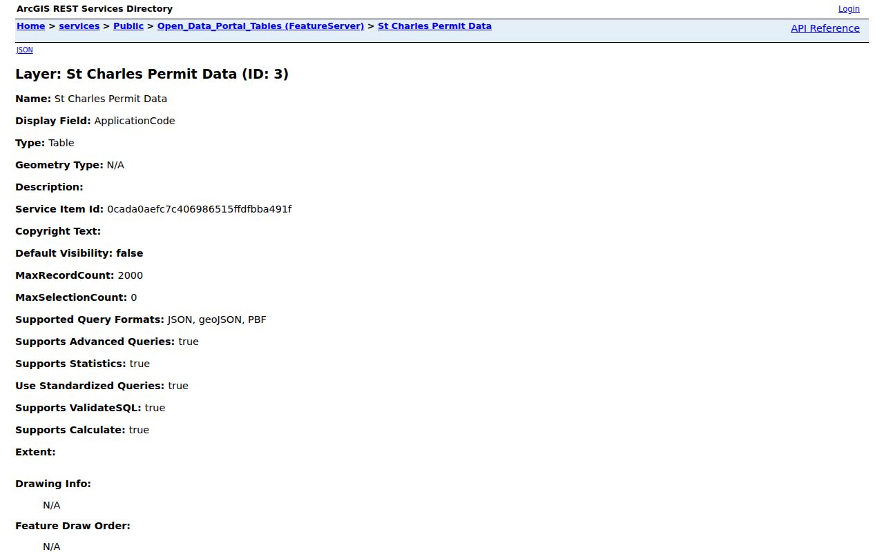
The screen helps date work at a site, but a contact may be an owner, builder, or designer. No public code-case lookup was found. Request missing municipal files through St. Charles FOIA. Illinois FOIA generally provides five business days for a response, subject to extensions.
Old St. Charles Street Language
The 1857 Ferslew directory uses “Main bt 1st and 2nd,” “5th cor Ohio,” and “Cedar bt 7th and 8th.” Here, bt means between, cor means corner, h means home, and bds means boards.
Central includes the original 1830s town. Moody-Millington reflects 1842 and 1846 additions, while Millington was annexed in 1842. Map old cross streets before trying a modern number. No official citywide renumbering year was found.
The library reports Tri-City directories from 1910 to present, with 1910–11, 1912–13, and 1943 catalog-confirmed. Ask for the exact year and address section. The St. Charles city directory collection explains those shelves without assuming every year survives.
St. Charles Voter Street Limits
The Kane County voter search is useful only when a person’s name is already known. It accepts a last name with a house number or street name. A matching result may show voter name, address, registration status, polling places, and districts. It does not offer an anonymous export of everyone on a street. Full voter-file access is governed by 10 ILCS 5/1A-16 and is not the same service as the casual web lookup.
Use a voter result as one dated association. Compare it with the parcel's situs address and correct county, since a postal St. Charles label does not settle municipal status. Phone numbers, Social Security numbers, full birth dates, and other protected fields do not appear in the public detail. A missing result can reflect the query, registration status, county, or a privacy protection. It cannot prove that a person does not live at the address.
This is where a street directory must remain modest. The official form can test a known name against a St. Charles street, while DevNet tests an address against the owner roll. Those are different questions and should not be merged into a household claim.
Missing St. Charles Address Files
Web portals are only the first access channel. For old deeds, use the Recorder's Geneva research room, public computers, index books, and microfilm. For a city permit or code record absent from open data, submit a narrow written request that gives the address, approximate dates, record type, and known permit or case number. For historical directory work, contact the library or museum with the exact year and street wording.
An Illinois FOIA request does not need special legal phrasing. It should identify the custodian and describe the public record well enough to find it. The general response period is five business days, subject to the extension allowed by statute. Fees and exemptions depend on the record. Ask for an electronic copy when that form already exists, and request an explanation if part of the file is withheld.
These fallback routes make the St. Charles street directory more complete without claiming that all records are online. They also preserve the source office behind each fact. A clerk, assessor, recorder, or librarian can resolve an indexing gap that a broad web search cannot.
Limits of St. Charles Street Records
A tax roll names an indexed owner, not every resident. A voter result covers one named registration. A deed records title. A permit contact may be an owner, builder, or other party. Utility, delivery, and private group lists are not public street rolls.
Illinois restricts DMV address data. The Address Confidentiality Program can substitute an address in new public records for eligible survivors, though old deeds are not erased. These limits are part of an accurate street directory, not gaps to fill with guesses.
Lawful use. Use St. Charles address records for lawful personal research. Never stalk, threaten, harass, deceive, or harm anyone.
When records conflict, return to the custodian and date. Confirm the county, distinguish mailing from situs, and ask for the underlying record. A reliable street directory result states what the record proves, what it does not prove, and when the issuing office last updated it.